
Civil & Geospatial
Land Survey Drafting
Accurate survey drawings to help you build with confidence

Why Arcengine
Drafting built for accuracy and trust
Quality-first drafting
At Arcengine, we understand the importance of this job, therefore our main focus lies in developing and delivering high-quality cad drawings that are accurate and provide the client/firms with all the information they are looking for. We work with the latest drafting software and our team is trained in each one of them, that is why our drawings are of top-class quality.
Industry-standard toolset
Arcengine is an entrenched drafting services business by contributing to an extensive array of land survey cad drafting services. We serve survey professionals, and their company, we can work with many advanced tools and industry-standard software such as AutoCAD Civil 3D, Autodesk, Micro Station, AutoCAD, Revit etc. as per the requirement of clients for CAD drafting.
Accuracy you can verify
Land survey drafting requires accuracy to detail. At Arcengine is equipped to understand the distinctions of the work with focus to generate drawings that are 100% accurate CAD drafting services. We follow a set of protocols that help us verify the quality of our work and ensure that we are in sync with client requirements. We have worked with global clients and earned trust by providing quality drafts. Arcengine provides exemplary services, and we prioritize client satisfaction.
What we draft
Our Categories
-
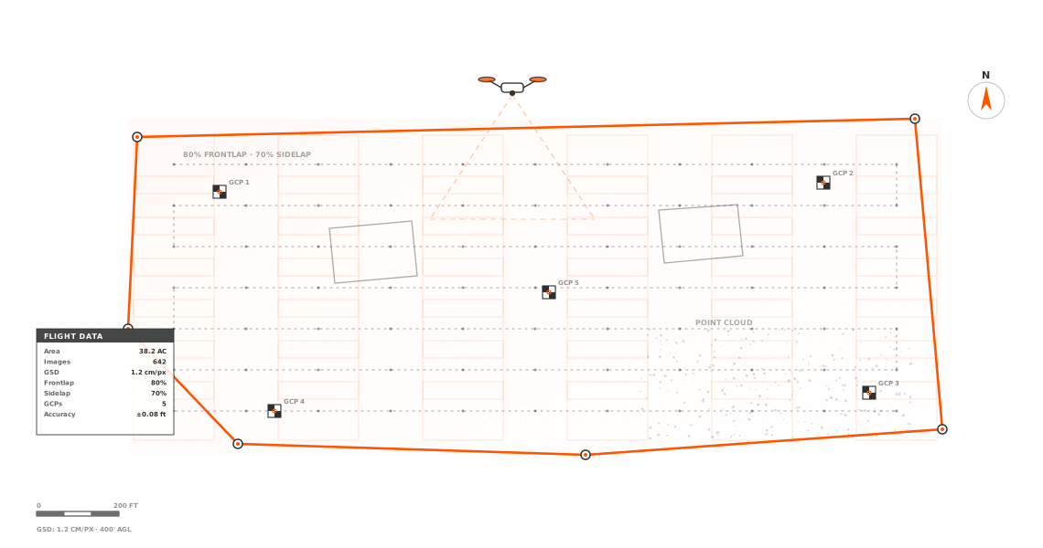
Aerial imagery and photogrammetry drafted into accurate, scaled base maps and planimetrics.
-
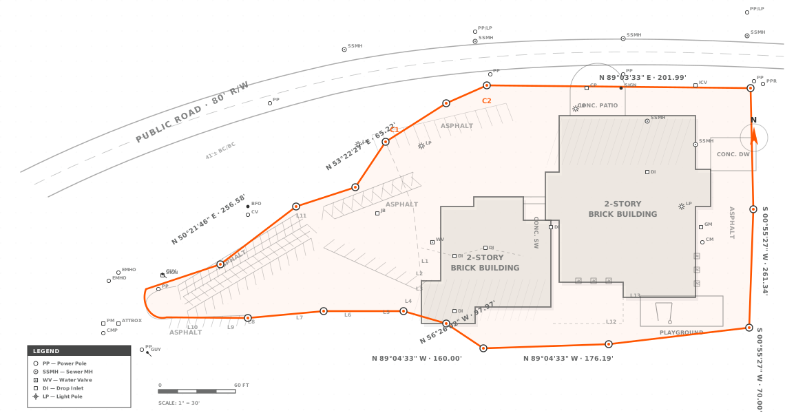
ALTA Land Survey Drafting services provide detailed and accurate mapping solutions for commercial real estate transactions. These surveys meet the strict requirements for title insurance, highlighting boundary lines, easements, and property features to support informed decision-making and secure land development.
-
Field-verified as-built drawings documenting what was actually constructed against the design.
-
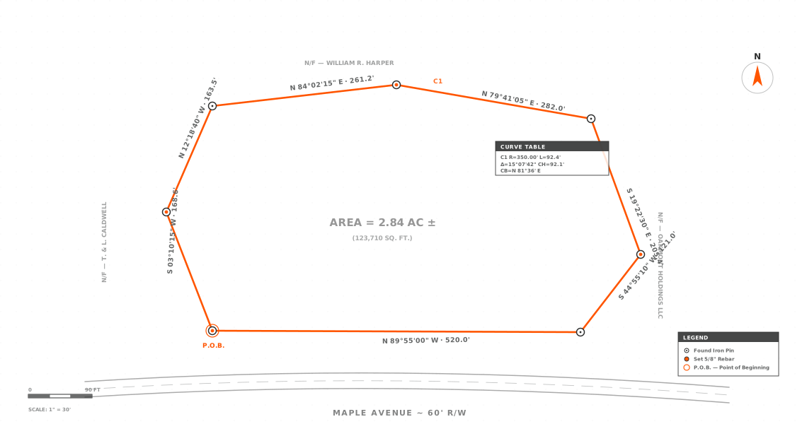
Our Boundary Survey Drafting provides precise delineation of property lines to define legal land ownership and prevent disputes. These detailed drawings accurately represent boundary markers and measurements, ensuring clarity and compliance in all land development and documentation processes.
-
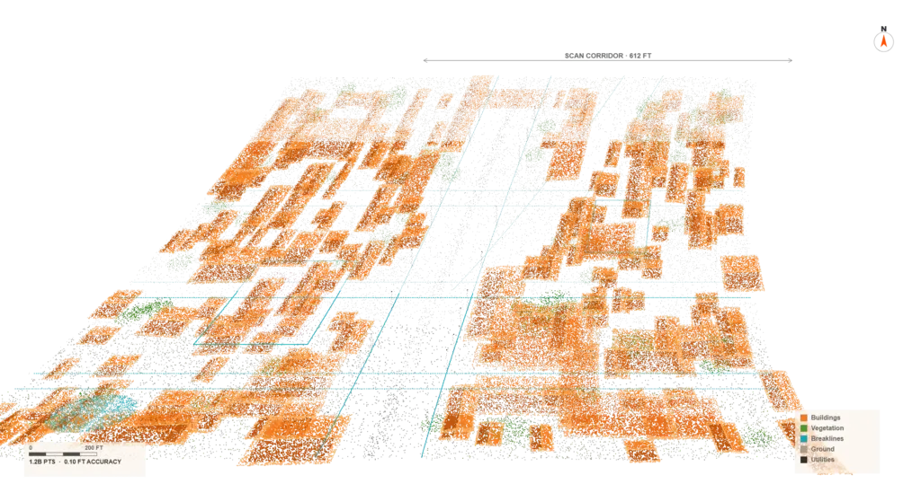
Point clouds registered and processed into clean, drafting-ready surfaces and deliverables.
-
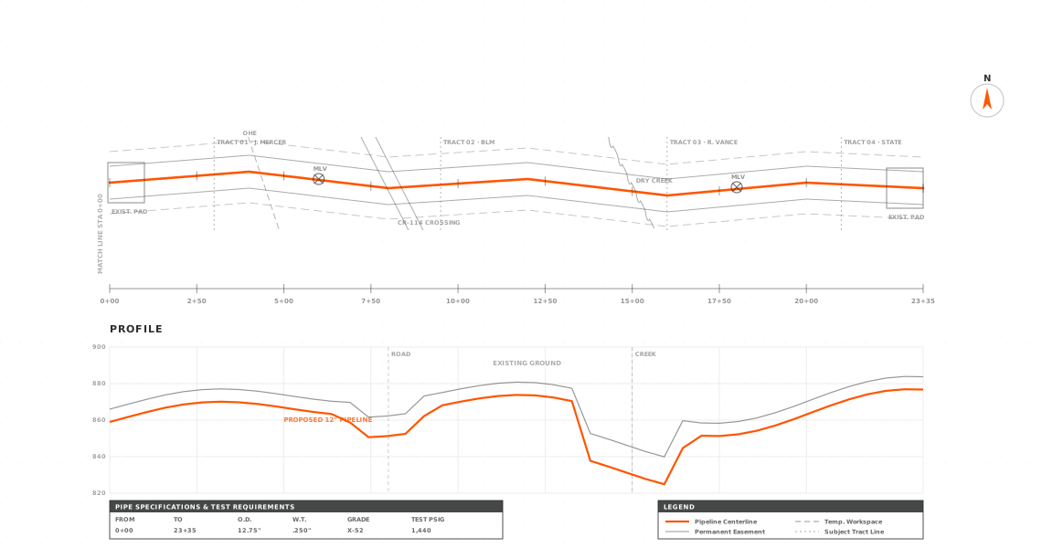
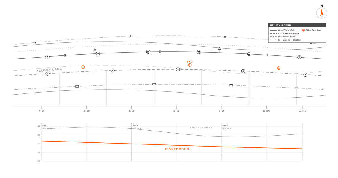
Alignment sheets with plan, profile, stationing, easements, and crossings for pipeline corridors.
-
At Arcengine, a Right of Way (ROW) Survey is a specialized surveying service focused on land designated for transportation and utility purposes, including roads, highways, and access corridors. Our ROW surveys support the planning, design, and modification of existing rights of way by accurately addressing all legal, physical, and operational considerations, ensuring compliance and clarity at every stage of the project.
-
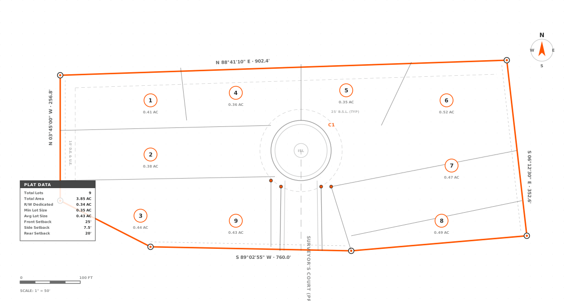
Subdivision and plat drafting with lots, easements, and right-of-way dedications.
-
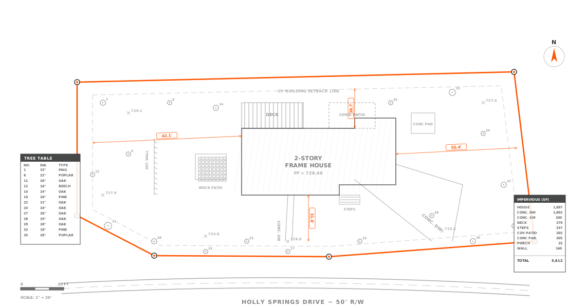
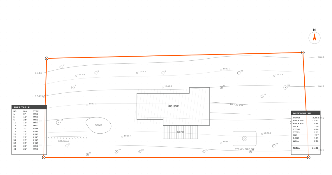
It conducted by a land surveyor to provide the mapping traits of the land. Surveyors carefully consider all real things approaching closer to the surface, such as buildings, maintaining walls, utility poles, trees, streets, man-holes, walkways, etc. Arcengine makes sure to draft such intense details and contour lines to show whether the property stands by a particular elevation mark on a given locality.
-
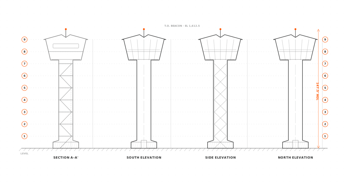
At Arcengine, Tower Surveys Drafting focuses on the accurate mapping and documentation of sites designated for communication, transmission, and utility towers. Our drafting process captures critical details such as tower location, foundations, access roads, boundary limits, existing structures, terrain features, and nearby utilities. These precise drawings support efficient planning, design, installation, and maintenance of tower infrastructure, ensuring safety, compliance, and seamless project execution.
-
At Arcengine, Utilities Survey Drafting involves the accurate documentation and representation of both above-ground and underground utility infrastructure within a project area. This includes utilities such as water lines, sewer systems, storm drains, electrical cables, gas pipelines, communication networks, and related appurtenances. Our drafting team ensures precise, well-coordinated drawings that support effective planning, design, and construction, while minimizing risks, conflicts, and delays during project execution.
-
Construction staking or construction layout is the method of investigating and understanding architectural and civil engineering projects and assessing them. It is for identifying the area offered for new construction for roads or buildings.
-
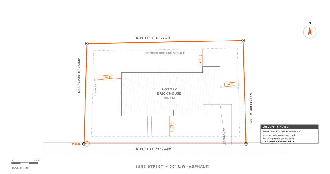
We deliver a clear and accurate depiction of a property for legal and financing purposes. It identifies property boundaries, existing structures, access points, and visible improvements. Our detailed drawings assist lenders, buyers, and legal professionals in property evaluation. This ensures regulatory compliance and supports smooth, reliable property transactions.
-
CAD Conversion services transform paper drawings, scanned images, PDFs, and legacy files into precise, editable CAD formats. Our team ensures accurate conversion while maintaining original dimensions, scales, layers, and annotations. These digitized drawings enhance clarity, improve data management, and support seamless integration with modern design, drafting, and engineering workflows.
How it works
Our Process
A clear, four-step workflow that takes your project from brief to final survey drawings, drafted to standard and delivered on schedule.
Understand Your Requirements
We confirm your project goals, survey scope, and CAD standards before drafting begins.
Smart Planning & Setup
We organize the survey data and set CAD templates and standards for accuracy and consistency.
Precision Drafting & Quality Control
We draft your survey drawings with precision, backed by multi-level quality checks.
On-Time Delivery & Support
We deliver in your required formats, approval-ready, with support for revisions.
Why Arcengine
Why Choose Us?
Transparent & Competitive Pricing
We offer high-quality drafting services at reasonable rates, with pricing fixed at the start of the project and no hidden costs.
Accurate & Clear Drawings
Our drawings are precise, well-structured, and compliant with industry standards, ensuring clarity and reliability.
Experienced Drafting Professionals
Our skilled team brings extensive expertise in producing world-class land survey drafts across diverse projects.
On-Time Project Delivery
We value our clients’ time and strictly adhere to agreed timelines and deadlines.
Quick Turnaround Times
Efficient workflows enable us to deliver quality outputs promptly without compromising accuracy.
Client-Focused Approach
Client satisfaction is our priority: we welcome feedback and provide revisions to ensure the final deliverables meet expectations.
Where it applies
Industries We Serve
Civil Engineering & Infrastructure
Accurate base data for roads, bridges, railways, and public infrastructure, with precise boundaries and elevations that keep design and construction aligned.
Oil, Gas & Energy
Drafting for pipeline routing, facility planning, and right-of-way management, with detailed drawings that cut risk and keep complex energy projects compliant.
Surveying & Engineering Firms
White-label CAD drafting support so your team can focus on fieldwork and core engineering while we deliver consistent, scalable output.
Transportation & Utilities
Clear, detailed drawings for roads, highways, rail corridors, and utility networks that support planning, upgrades, and maintenance while reducing construction errors.
Land Development & Subdivision
Accurate boundary, topographic, and layout drawings for lot division and regulatory submissions, so developers can move ahead with confidence.
GIS Mapping
Well-structured spatial data that imports directly into GIS systems for mapping, visualization, and asset management.
By the numbers
Our Experience
Proven expertise and measurable results across projects of every scale, shown in the numbers below.
12+
Years of Experience
Of drafting, detailing and BIM work.
70+
Team Members
CAD drafters, detailers and BIM modelers.
90+
Clients Served
Firms that have sent us drafting, detailing and BIM work.
150K+
Hours a Year
Production hours a year in drafting, detailing and BIM.
FAQs
Frequently Asked Questions
We draft the full range of land survey drawings: ALTA/NSPS, boundary, topographic, as-built, aerial, LiDAR, route, pipeline, subdivision, tower, and utility surveys, delivered as 2D and 3D CAD files.
We deliver in AutoCAD DWG and DXF, PDF, and any format you specify, drafted to your layer standards and ready for approvals or construction.
Turnaround depends on the complexity and volume of drawings, but our workflow and dedicated drafters keep projects on agreed timelines, with rush options when you need them.
Every drawing passes multi-level quality checks against your standards and the source survey data, so what you receive is precise and consistent.
Yes. We work under NDA and follow strict data-security practices to keep your survey data and project information confidential.
Yes. Each of our state pages covers that state’s coordinate zones, plat rules and the drawings its surveyors ask for: Alabama, Arizona, California, Colorado, Florida, Georgia, Illinois, Indiana, Louisiana, Massachusetts, Michigan, Missouri, New Jersey, New York, North Carolina, Ohio, Oregon, Pennsylvania, South Carolina, Tennessee, Texas, Virginia, Washington and Wisconsin.
Member of & Associated With
Recognized across the industry



Get in touch
Start your survey drafting project
Send us your survey data or project brief, and our drafting team will reply with a project plan and quote.