
Land Survey Drafting
Pipeline Survey Drafting
Specialist survey drafting for oil and gas pipeline projects, supporting route planning, construction, maintenance, and regulatory compliance.
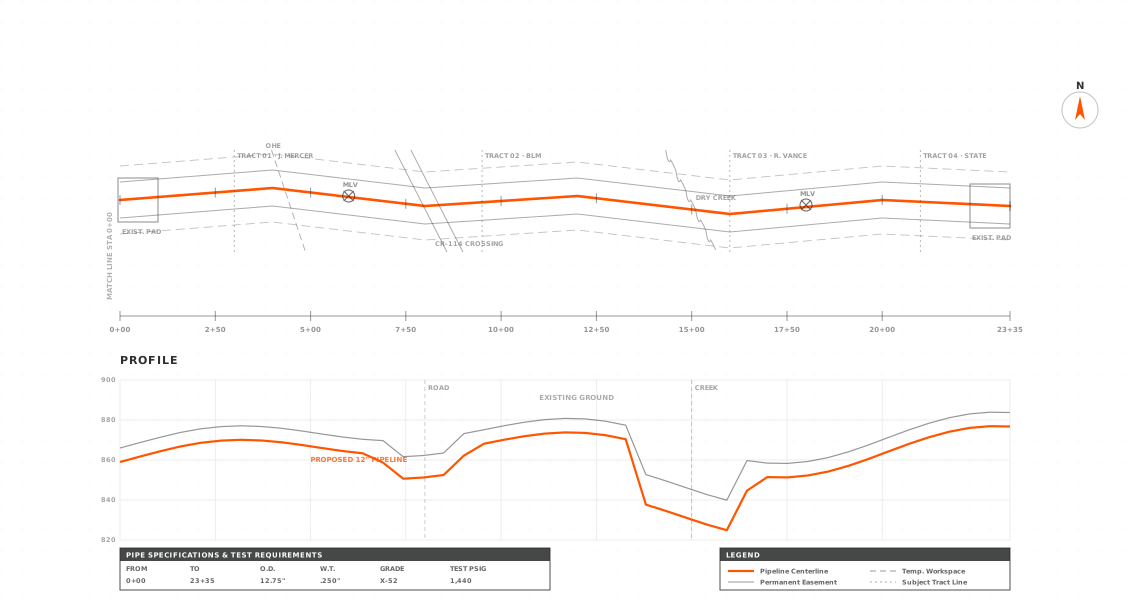
Overview
What is a pipeline survey?
Oil and gas pipeline construction requires detailed engineering assessment, precise route surveys, and strategic route selection for safe and efficient execution. Accurate survey drafting with advanced CAD and GIS technologies helps the project team work through terrain challenges, environmental constraints, and site-specific obstacles, so planning rests on reliable data.
For oil and gas transportation projects, route selection is the starting point of pipeline development. Along with estimating material quantities, planning has to weigh legal regulations, environmental impact, land ownership, soil conditions, terrain variations, and engineering requirements. Well-prepared pipeline transportation maps and survey drawings help deliver cost-effective, environmentally responsible routes that stay compliant and limit impact on surrounding land and communities. Detailed oil and gas pipeline survey drafting supports accurate design decisions and smoother project implementation.
At a glance
- StandardEngineering & regulatory survey standards
- Best forOil & gas pipeline projects
- CoversRouting, ROW & plan-profile
- DeliveryAutoCAD DWG · PDF
- Your roleYou stay surveyor of record
What we deliver
What's included
We produce detailed survey drawings that support pipeline planning, routing, construction, and asset management across oil and gas projects.
Pipeline Route Survey Drafting
Preparation of detailed route alignment drawings based on field survey and GIS data for accurate pipeline corridor planning.
Alignment Sheets & Plan-Profile Drawings
Creation of pipeline alignment sheets, longitudinal profiles, and cross-sections for engineering review and construction execution.
Right-of-Way (ROW) & Easement Drafting
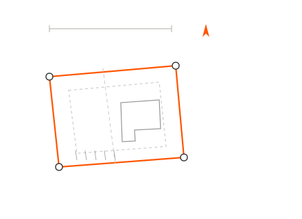
Drafting of ROW plans, land acquisition maps, and easement drawings in compliance with regulatory and land ownership requirements.
Topographic Survey Drafting for Pipelines
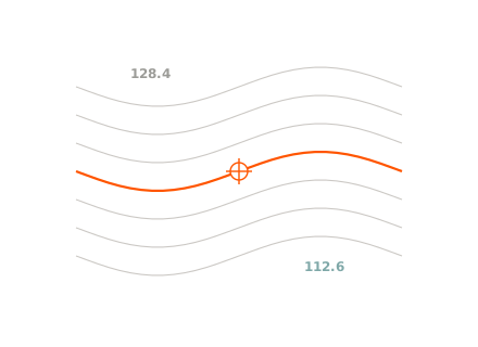
Conversion of topographic survey data into detailed CAD drawings showing contours, elevations, and terrain conditions.
GIS Mapping & Data Integration
Integration of GIS datasets with CAD platforms for accurate pipeline mapping, obstacle identification, and environmental assessment.
As-Built Survey Drafting
Preparation of as-built pipeline drawings reflecting actual installed conditions for documentation and compliance.
Crossing & Utility Conflict Drawings
Drafting of highway, railway, river, and utility crossing plans with detailed engineering references.
Hydrological & Environmental Constraint Mapping
Mapping of wetlands, water bodies, flood zones, and protected areas affecting pipeline route selection.

Why it matters
Why is a Pipeline Survey Necessary?
Pipeline survey drafting is essential to the safe, accurate, and cost-effective planning of oil and gas pipeline projects. It transforms field survey data, GIS inputs, and engineering analysis into precise CAD drawings that guide route selection, regulatory approvals, and construction execution. Our accurate survey drafting reduces risk, prevents costly design errors, and keeps drawings in line with environmental and legal requirements. Pipeline survey drafting provides detailed alignment plans, topographic maps, and right-of-way drawings that support informed decisions throughout the project lifecycle.
Guides accurate route selection through careful analysis of terrain conditions, soil characteristics, and environmental constraints.
Supports regulatory approvals with compliant survey drawings and detailed right-of-way (ROW) documentation.
Flags existing utilities, water bodies, crossings, restricted zones, and other obstacles early, before construction begins.
Reduces construction risk and avoids costly on-site changes through precise planning and documentation.
Improves coordination between engineers, surveyors, contractors, and project stakeholders.
Drives accurate material estimation, efficient installation, and clear execution planning.
Where it applies
Industries We Serve
Oil, Gas & Petrochemical Industry
Supports routing, alignment planning, and documentation of crude oil, natural gas, refined product, and process pipelines across onshore fields, refineries, and industrial complexes.
Water Supply, Irrigation & Wastewater
Assists in the design and layout of potable water transmission lines, irrigation networks, sewer systems, and drainage pipelines for municipal and agricultural applications.
Energy & Utility Sector
Enables planning of district heating, cooling pipelines, and utility corridors that support power generation facilities and urban energy distribution networks.
Municipal & Government Infrastructure
Used for public utility planning, smart city projects, urban development programs, and large-scale infrastructure initiatives.
Construction & Transportation Projects
Helps coordinate pipelines on roadway, highway, railway, airport, and large construction developments to avoid conflicts with other utilities.
Industrial & Manufacturing Facilities
Provides detailed routing for process pipelines, chemical transport lines, and plant utility systems within industrial zones and production facilities.
Environmental & Land Development Projects
Supports right-of-way planning, environmental impact assessments, terrain analysis, and sustainable pipeline installation across sensitive or complex landscapes.
How it works
Our End-to-End Process
Data Collection & Review
We gather field survey data, topographic information, GIS datasets, and project specs, then review every input for completeness and accuracy before drafting begins.
Route Analysis & Planning
We analyze terrain, soil data, environmental constraints, and right-of-way requirements to support the choice of an optimal, feasible route alignment.
CAD Drafting & GIS Integration
We convert survey data into detailed CAD drawings, alignment sheets, plan-profile drawings, cross-sections, and ROW maps, integrated with GIS.
Quality Control & Compliance Check
Every drawing passes a quality-assurance review against industry standards, regulatory guidelines, and your project requirements.
Final Delivery & Ongoing Support
We deliver permit-ready, construction-ready pipeline survey drawings in required formats and provide ongoing revisions or technical support as needed.
Why Arcengine
Why Choose Us
Industry-Focused Expertise
Our team knows the technical requirements of oil and gas pipeline projects and delivers accurate, standards-compliant survey drafting.
CAD & GIS Technology
We use current CAD and GIS tools to produce precise alignment sheets, route maps, and right-of-way drawings.
High Accuracy & Quality Control
Every drawing goes through a strict quality review process to catch errors, reduce risks, and deliver construction-ready documentation.
Regulatory & ROW Compliance
We prepare survey drafts that meet local regulations, environmental guidelines, and land acquisition requirements for smooth approvals.
Cost-Effective & Scalable Solutions
Our flexible engagement models allow you to scale resources based on project size while maintaining cost efficiency.
Timely Delivery & Reliable Support
We prioritize fast turnaround times and provide continuous technical support to keep your pipeline project on schedule.
Explore more
Our Other Services
FAQ
Frequently Asked Questions
Accurate survey drafting identifies terrain challenges, utility conflicts, environmental constraints, and right-of-way boundaries before construction begins. This proactive planning minimizes costly field changes, delays, and compliance issues.
Services typically include route alignment plans, plan and profile drawings, cross-sections, topographic survey drafts, ROW maps, utility crossing drawings, and as-built documentation prepared for oil and gas projects.
ROW drafting supports proper land acquisition planning, legal compliance, and coordination with landowners. It helps avoid disputes and makes project approvals smoother.
Yes, structured drafting workflows allow scalable support for long-distance transmission pipelines, distribution networks, and multi-phase infrastructure developments.
Precise drafting improves material estimation, reduces rework, prevents design conflicts, and makes construction more efficient, which lowers overall project costs.
Get in touch
Pipeline drafting, construction-ready
Send us your field survey, GIS, and route data. We'll return permit-ready alignment sheets, plan-and-profile drawings, and ROW maps in AutoCAD DWG and PDF.