
BIM Modeling Services
Point Cloud to BIM
Send your registered laser-scan point cloud and we turn it into an accurate Revit model: walls, floors, structure, and MEP, built to the LOD your project needs.
Overview
What is Point Cloud to BIM?
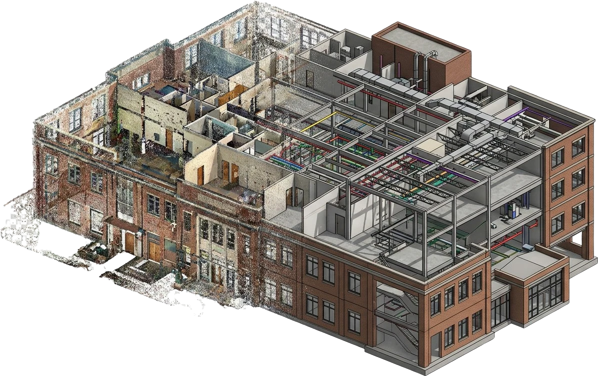
Point Cloud to BIM is the process of turning a registered 3D point cloud, usually captured by laser scanning, into a parametric BIM model. The cloud holds millions of measured points recording the surfaces the scanner could see, and on its own it is only reference data. We use it as the measured backdrop and build walls, floors, columns, roofs, and MEP as Revit elements aligned to those points.
This service starts with a cloud you already have. You send an aligned, registered dataset, we confirm it opens cleanly, and then we model to the agreed Level of Development (LOD). Because the capture is done, the whole engagement goes into modeling. We work through noise and the overlap between scan positions, and place each element within tolerance of the points.
We handle point cloud to Revit modeling for architecture, structure, and MEP, all built from the same cloud into one coordinated model. Your team can plan a renovation or retrofit against it and keep it for facility management.
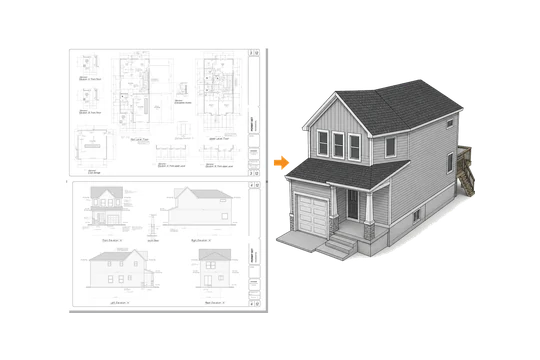
Cloud to model
Your registered cloud→one coordinated model
What we deliver
What's included in a Point Cloud to BIM project
We build and check every model against your registered cloud. You get coordinated Revit geometry for the disciplines in scope, aligned to shared coordinates and delivered to your standards.
-
Cloud Setup & QA
We index your registered cloud, check alignment and units, and flag any gaps before modeling starts.
-
Architectural Model
Walls, floors, ceilings, roofs, stairs, doors, windows, and openings modeled to the scanned geometry.
-
Structural Model
Columns, beams, slabs, and exposed framing modeled as coordinated structural elements.
-
MEP Model
HVAC ductwork, plumbing pipe runs, cable trays, and visible equipment modeled from the same cloud where in scope.
-
LOD to Spec
Elements built to the agreed Level of Development (LOD) 200 to 350, with the element list confirmed up front.
-
Tolerance Check
Geometry verified against the points so the model stays within the agreed deviation.
-
Coordinated Delivery
Native RVT plus IFC and DWG on request, on your template, coordinates, and naming rules.
Input formats
Point cloud formats we work with
You send us an already-registered cloud and we model it to the agreed LOD. We accept the common formats your scanning team exports, listed below, and confirm the dataset opens cleanly and reads at the right units and coordinates before modeling starts.
.E57
E57
The vendor-neutral ASTM E2807 exchange standard. Most scanner and registration software exports it, and it is the format we receive most often.
.RCP / .RCS
ReCap Project
Autodesk ReCap's indexed cloud, ready to reference directly into Revit. RCP holds the project, RCS the individual scans.
.PTS
PTS
A plain-text points file with XYZ, intensity, and RGB values, common in Leica workflows and easy to check before modeling.
.LAS / .LAZ
LAS / LAZ
The LiDAR standard used for aerial and mobile scans. LAZ is the compressed form of the same data for large sites.
.PLY
PLY
Polygon and point format from photogrammetry and mesh tools, useful when the cloud comes from image-based capture.
.XYZ
XYZ
A simple ASCII list of point coordinates, sometimes with color. It is a reliable fallback when no other export is available.
If you have raw scans that still need registering, our Scan to BIM service registers them into one aligned cloud before modeling. If you have no scan yet, we can advise on capture coverage.
Why it matters
Why convert a Point Cloud to BIM?
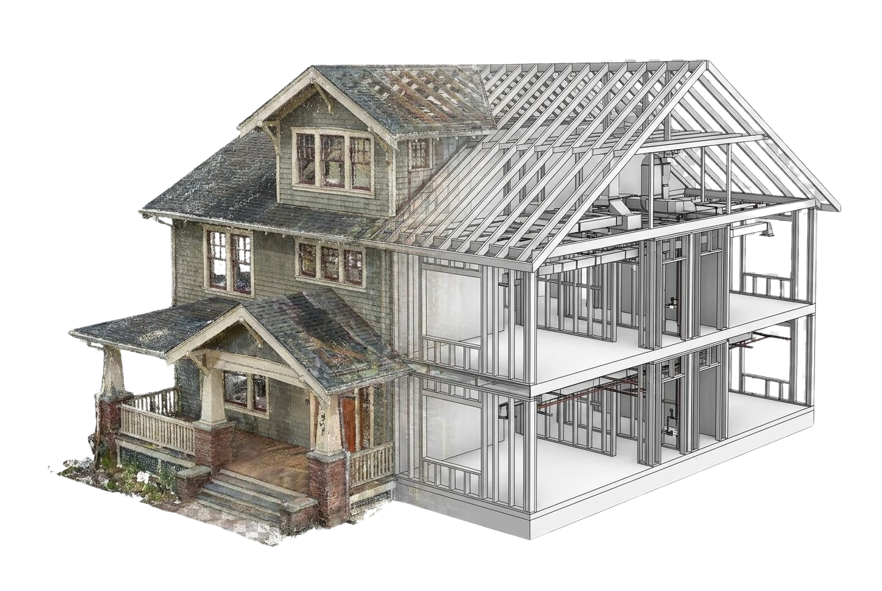
A point cloud is a measured record of what exists, but it holds only points: no walls, rooms, or data to design or build against. Turning it into BIM gives your team measurable geometry of the existing conditions to renovate, extend, coordinate, and document from.
You already hold the cloud, so what you need now is a clean, tolerance-checked BIM model. Your team can take dimensions from the model instead of going back to the site, and every downstream discipline works from the same measurements.
-
A raw cloud is reference data. BIM turns it into parametric elements you can model, schedule, and edit.
-
The model follows the measured dimensions of the existing building, so design decisions rest on site conditions rather than old drawings.
-
Framing and services are modeled against the same points as the walls, so everything lines up in one model.
-
Modeling to a defined LOD keeps the deliverable focused: enough detail for the task, without paying for unused geometry.
-
An accurate existing-conditions model surfaces clashes and fit issues before they reach the site.
-
Your team can generate plans, sections, elevations, and schedules straight from the finished model, with no separate redraw of the existing building.
Where it applies
Industries We Serve
-
01
Architects & Design Firms
Existing-conditions models from your survey cloud, ready to design renovations and additions against.
-
02
Structural Engineers
Accurate models of existing framing and slabs to assess, retrofit, and coordinate new structure.
-
03
MEP & Facilities Teams
As-operated models of ductwork, pipe, and equipment for upgrades and facility management.
-
04
General Contractors
Reliable existing-conditions BIM to plan, sequence, and de-risk work before crews mobilize.
-
05
Building Owners
A durable digital record of the asset for renovation, leasing, and long-term maintenance.
-
06
Heritage & Restoration
Precise models of historic fabric from scan data, preserving geometry that is hard to re-measure.
-
07
Industrial Facilities
Congested plant and process spaces modeled from dense clouds for retrofit and clash-free tie-ins.
How it works
Our Point Cloud to BIM Process
01
Receive & Verify
You send the cloud with any existing drawings and BIM requirements. We check format, units, alignment, and coverage.
02
Agree Scope & LOD
We confirm the disciplines, element list, LOD, and tolerance so the model matches your intent.
03
Model to the Cloud
We model each discipline in scope in Revit, with every element aligned to the scanned points.
04
QA & Tolerance Check
We check every element against the cloud for deviation and coordinate it across disciplines.
05
Deliver & Support
We issue RVT, IFC, and DWG to your standards and support revisions through sign-off.
Why Arcengine
Why Choose Us
12+ Years, 70+ People
Revit modelers who build existing-conditions models from registered scans, part of our drafting and BIM team.
Fixed Price, Deadlines Kept
You get a fixed-price quote before modeling starts and a delivery date we keep.
LOD You Define
We agree on the LOD, element list, and tolerance up front, so you get the detail your project calls for and no more.
Tolerance Verified
Geometry is checked back against the cloud, so the model stays true to the measured points.
Works to Your Standards
Your Revit template, shared coordinates, families, and naming rules, followed exactly.
Confidential & Secure
We'll sign an NDA before you share files, and we use your scan data only to build your model.
Explore more
Our Other Services
FAQs
Frequently Asked Questions
Point Cloud to BIM is the process of turning a registered 3D point cloud, usually from laser scanning, into a parametric BIM model. We use the cloud as the measured reference and build walls, floors, structure, and MEP as Revit elements at the agreed Level of Development (LOD).
We work with the common registered scan formats: E57, RCP and RCS from Autodesk ReCap, PTS, LAS and LAZ, PLY, and XYZ. Send whichever export your scanning team produces and we confirm it opens cleanly and reads in the right units before modeling starts.
Point Cloud to BIM starts from a cloud that is already registered, so the work is all modeling. Scan to BIM starts a step earlier, from raw scans that we register into one aligned cloud before modeling. Both end in the same kind of Revit model, and many firms use the two terms interchangeably.
We model to the LOD you specify, typically LOD 200 to LOD 350 as defined in the BIMForum LOD Specification. LOD sets how fully each element is developed. Accuracy against the cloud is a separate tolerance. We agree on the LOD, the tolerance, and the element list before production starts.
We model primarily in Autodesk Revit, using Autodesk ReCap to index clouds as RCP and RCS files that link into the model. You receive native RVT, plus IFC and coordinated DWG on request, built to your template, shared coordinates, and naming standards.
We model to the tolerance agreed before production, often expressed as a USIBD Level of Accuracy (LOA), and check every element against the registered cloud for deviation. Noise and registration error in the cloud limit how tight that tolerance can be, so we confirm the target after reviewing your data.
Yes. This service is point cloud to Revit modeling. We index your cloud in Autodesk ReCap, link it into Revit, and model walls, floors, exposed framing, ductwork, and pipe runs as native elements aligned to the points. You get an RVT built on your template.
Yes. We sign NDAs on request. Your point cloud, drawings, and Revit files stay confidential, and we use them only to build and check your model, never for another project or client.
Get in touch
Send the cloud, get the model
Send your registered cloud and the LOD you need. We will reply with a fixed-price quote, then deliver a coordinated Revit model in RVT, IFC, and DWG. To test us first, start with a pilot on a real model. The pilot is turned around in 48 hours.